

Tracking Overview
Learn how tracking works and get an overview of the key features.
PackTrack includes a location tracking system designed specifically for K9 teams. It can be used for both deployments and training activities.


Phone setup
Before using this feature, ensure that your mobile phone is correctly configured. An Android phone must have the “Location” setting enabled and the location settings for the PackTrack app should be set to “Allow all the time” and “Use precise location.”
If you’re using an iPhone, ensure that “Location Services” are enabled and that the location settings for the PackTrack app are set to “Always” with “Precise location” enabled. These settings allow the app to record accurate locations while the screen is off.
Note that PackTrack does not track your location unless you’re actively using the location tracking feature.
How it works
PackTrack’s location tracking system uses the GPS and other technologies in your mobile phone to record your location at regular intervals and plot a path as you follow a track. A map showing the tracked path, along with any associated statistics, is automatically attached to your training or deployment records.
The location tracking feature requires a modern iPhone or Android device running the latest version of the PackTrack mobile app. Download the app from the iPhone App Store or Android Google Play Store.
Deployment tracking
During tracking operations a K9 team will follow a scent trail. In deployments, they track an unfamiliar trail left by an individual that they must locate, apprehend, or rescue. During training, they follow the route set by a designated Track Layer for the exercise.
After configuring your track settings you may start the track. The system will record your path and can show it live on your phone as you progress. It’s typically easiest to turn off the screen and keep the phone in your pocket while actively tracking.
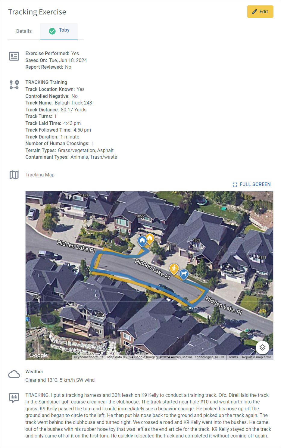
Once finished, you may choose to save the track or immediately complete the associated exercise or deployment record. All pertinent tracking data, including duration, distance, turns, and weather conditions, will automatically populate in your record along with a map displaying your route.
Training tracking
Unlike deployment tracking, training tracking is typically done with two people: the track layer and the track follower (K9 team). The track layer may use the PackTrack app for free, without an account, while the K9 team requires an account.
The track layer first uses the app to record their path. When the laid track is complete it becomes available to follow by any K9 team within 500 yards of the starting point. The K9 team selects the desired laid track within the app and tries to follow it as closely as possible.
Alternatively, the K9 team may choose to track without selecting a specific laid track. The track follower’s path is overlaid onto the track layer’s path (if provided) on a live map. This overlay provides insight into how accurately the K9 team followed the track layer’s scent.
Note that laid tracks have a limited life and will disappear after 3 days if not used by a track follower.
For detailed tracking instructions on each tracking mode, refer to the How To Use Location Tracking article.
Features
Map view
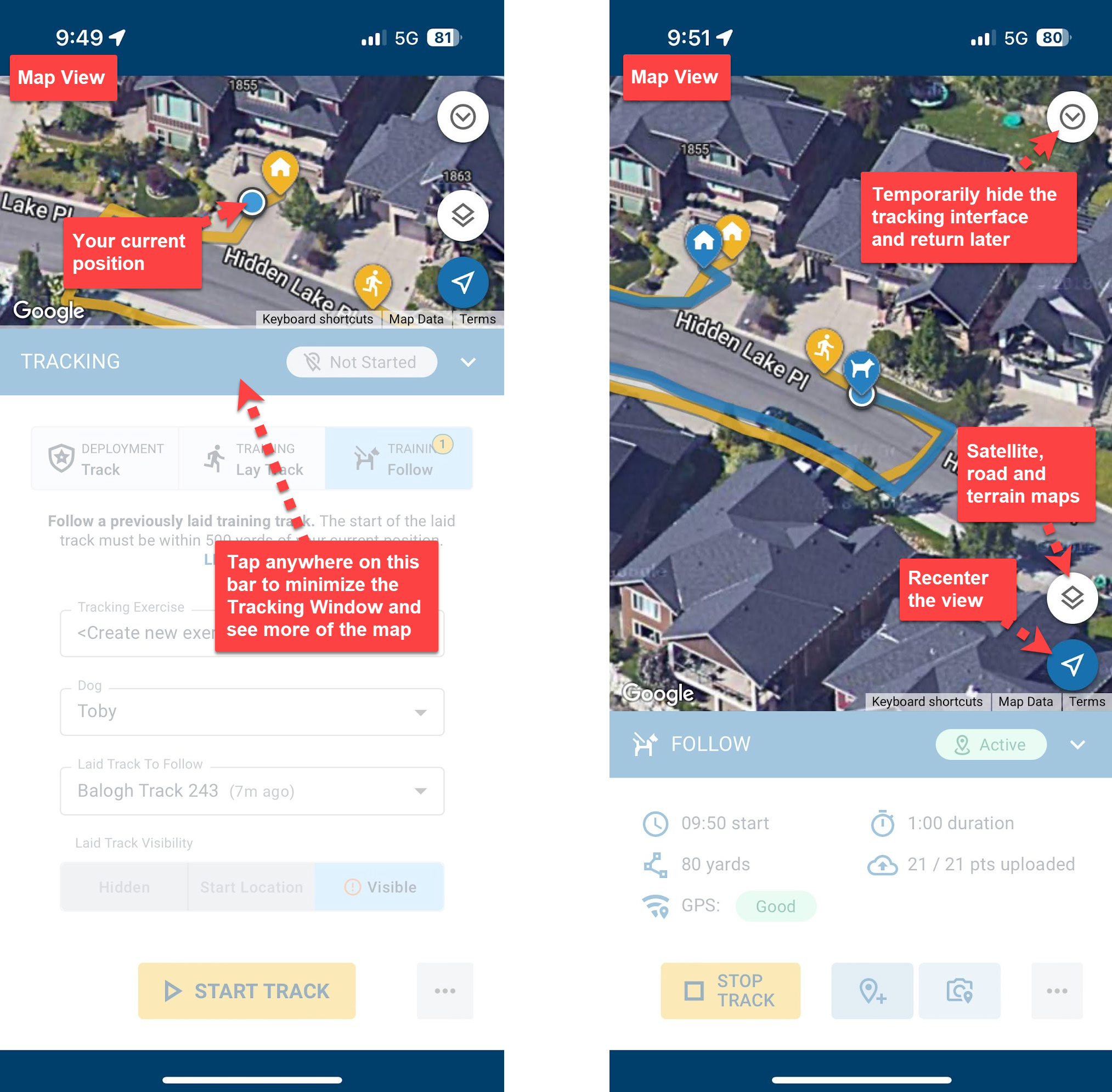
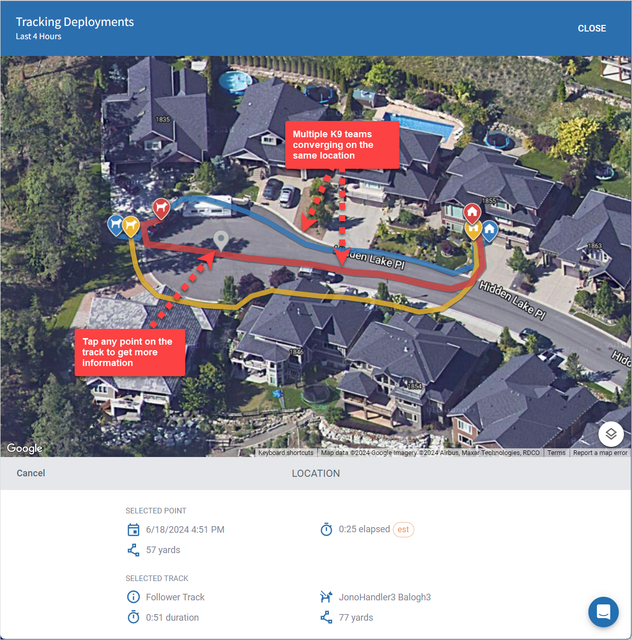
There are two parts to the tracking interface: the Map View (top) and the Tracking Window (bottom). The Map View is fully interactive and supports pan and zoom gestures. Tap on the Tracking Window title bar to minimize it and show more of the map.
If you’re viewing a track you can tap anywhere along the path to select a point and see more information in the Tracking Window. The Layers button in the bottom right of the map switches between Satellite, Road and Terrain map types.
If you drag the map then it will no longer scroll to keep you in the center. Use the “Recenter” arrow button, shown in the bottom right of the map, to reset your view and reenable automatic map scrolling.
Exit the map tracking screen at any time, even when actively tracking, using the “Minimize” arrow button in the upper right. Get back to your active track using the yellow “Return To Track” banner which is overlaid at the bottom of the screen.
Tracking window
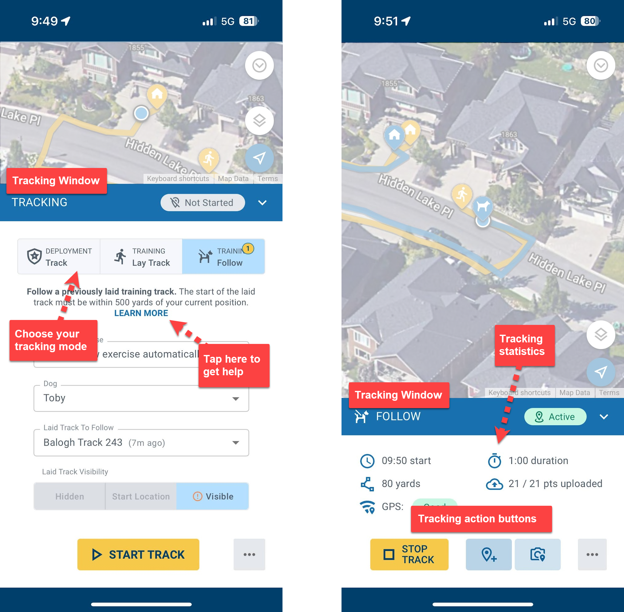
Use the Tracking Window to control and configure the track. There are three main tracking modes: deployment, training lay, or training follow. They all work similarly but have different configuration requirements.
Use the LEARN MORE links or the Help context menu in the bottom right of the screen to get detailed information on each mode. Once a track is started the Tracking Window switches to an Active Tracking view which displays your elapsed time, distance and other information.
Use the pin buttons to save a specific track location with a label and/or photo.
Tracking record integration
When the track is complete you can save it for later or choose to complete your record right away. Interactive tracking maps are automatically added to training and deployment records along with any calculated track statistics.
While location tracking can only be done in the app, both the app and PackTrack website allow you to interact with tracking maps and complete the associated records.
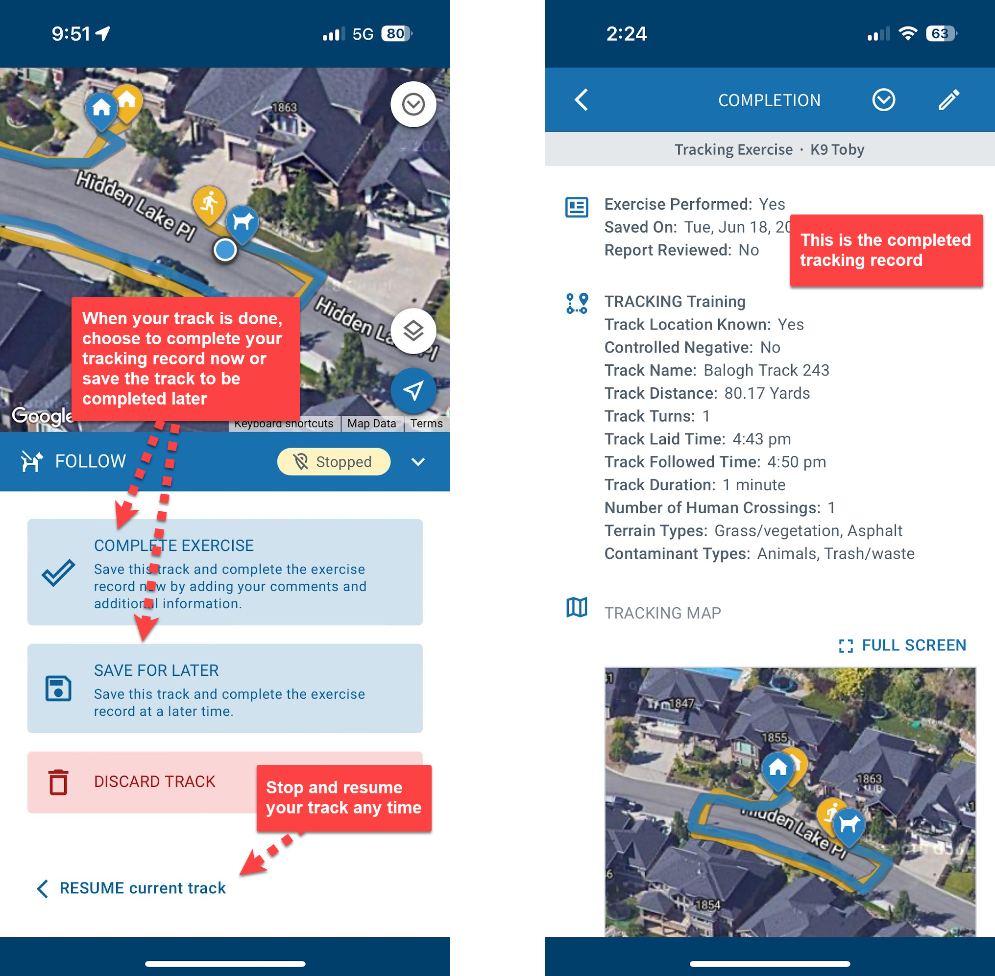
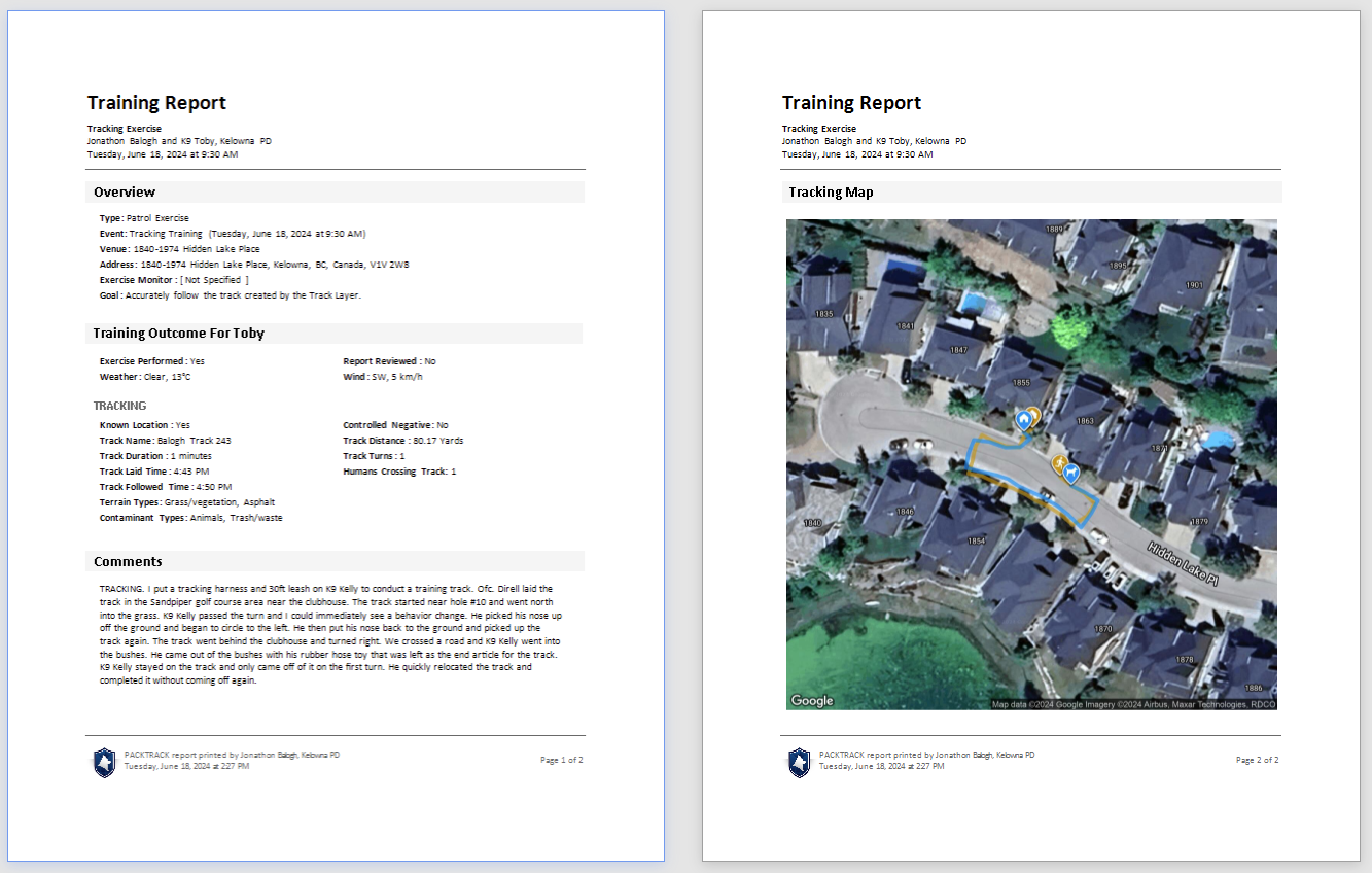
All tracking records can be used to generate reports showing the mapped track and any pinned track photos.
Location pins
Add pins to the track to identify important locations. Mark your current location on the map by pressing either of the pin buttons while tracking. You can also tap anywhere on a mapped track to select a different location and then tap the Save As Pin button.
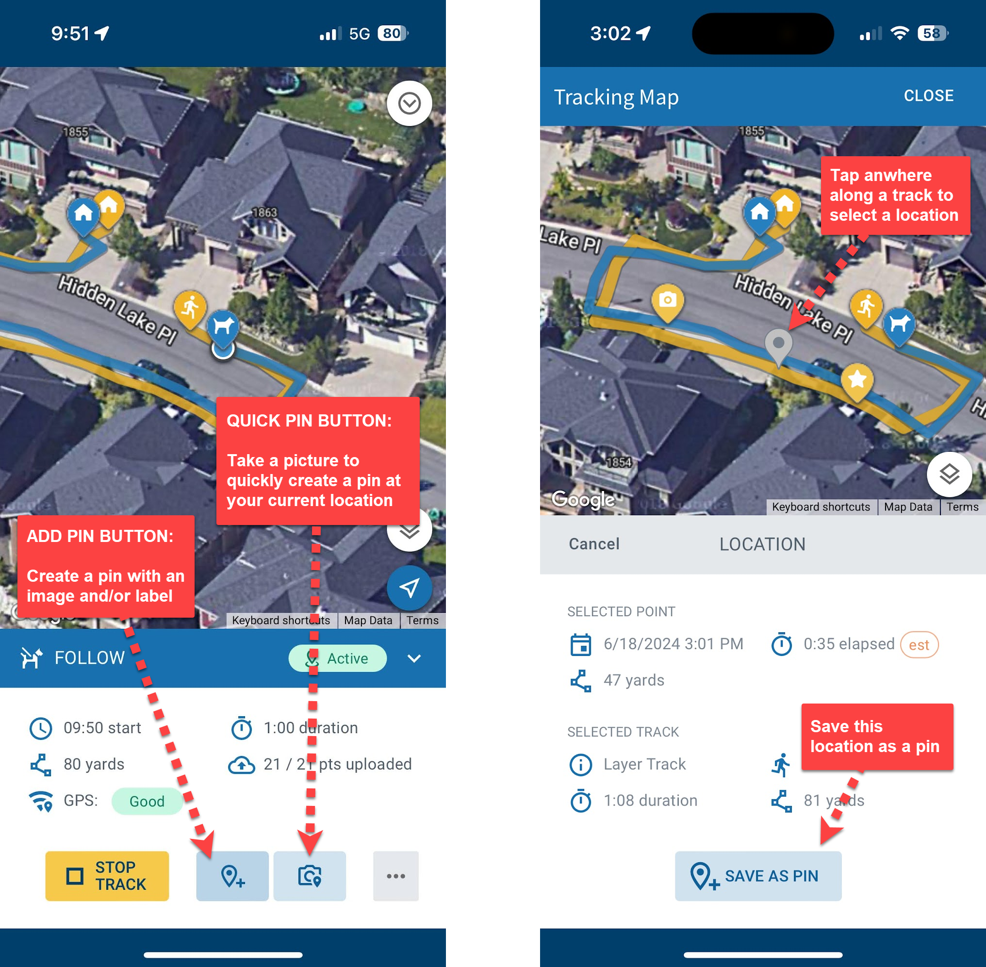
The Add Pin button is used to store a label and/or picture (from your library or camera) for the specified track location. The associated coordinates, distance and track duration are all stored with the pin.
When you’re in a hurry, use the Quick Pin button to capture your current track location by simply taking a picture. This is a handy way to document evidence without delaying your track. Pins may be added (or edited) either while the track is in progress or afterwards when it’s complete.
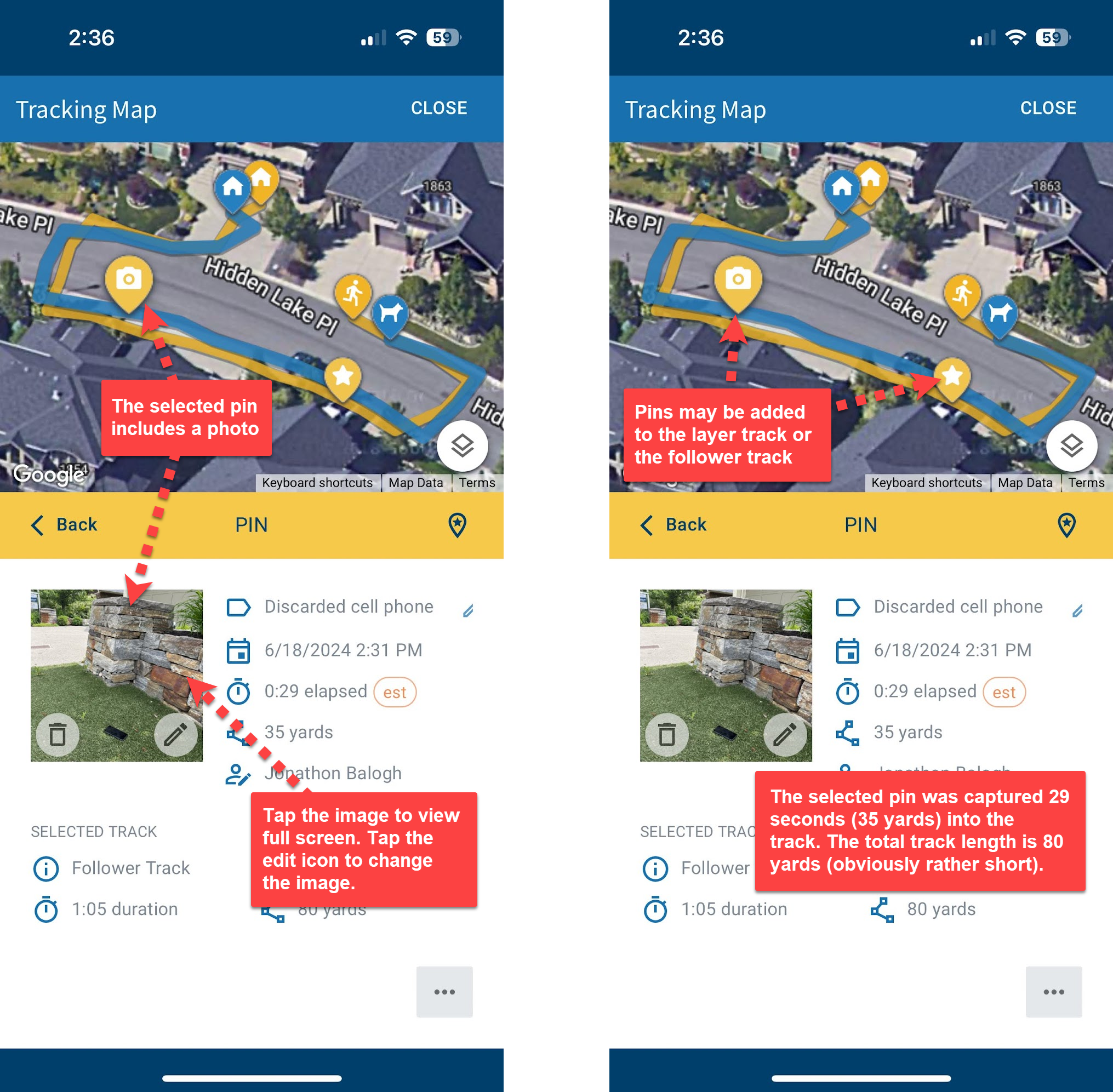
Pins are visible to the K9 team as they follow a training track but only if they’ve specifically chosen to reveal the laid track before starting. The layer and follower tracks, along with any added pins, are always visible after the K9 team follows the laid track. Laid tracks have a limited life and will disappear after 3 days if not used by a track follower.
Supervisor monitoring
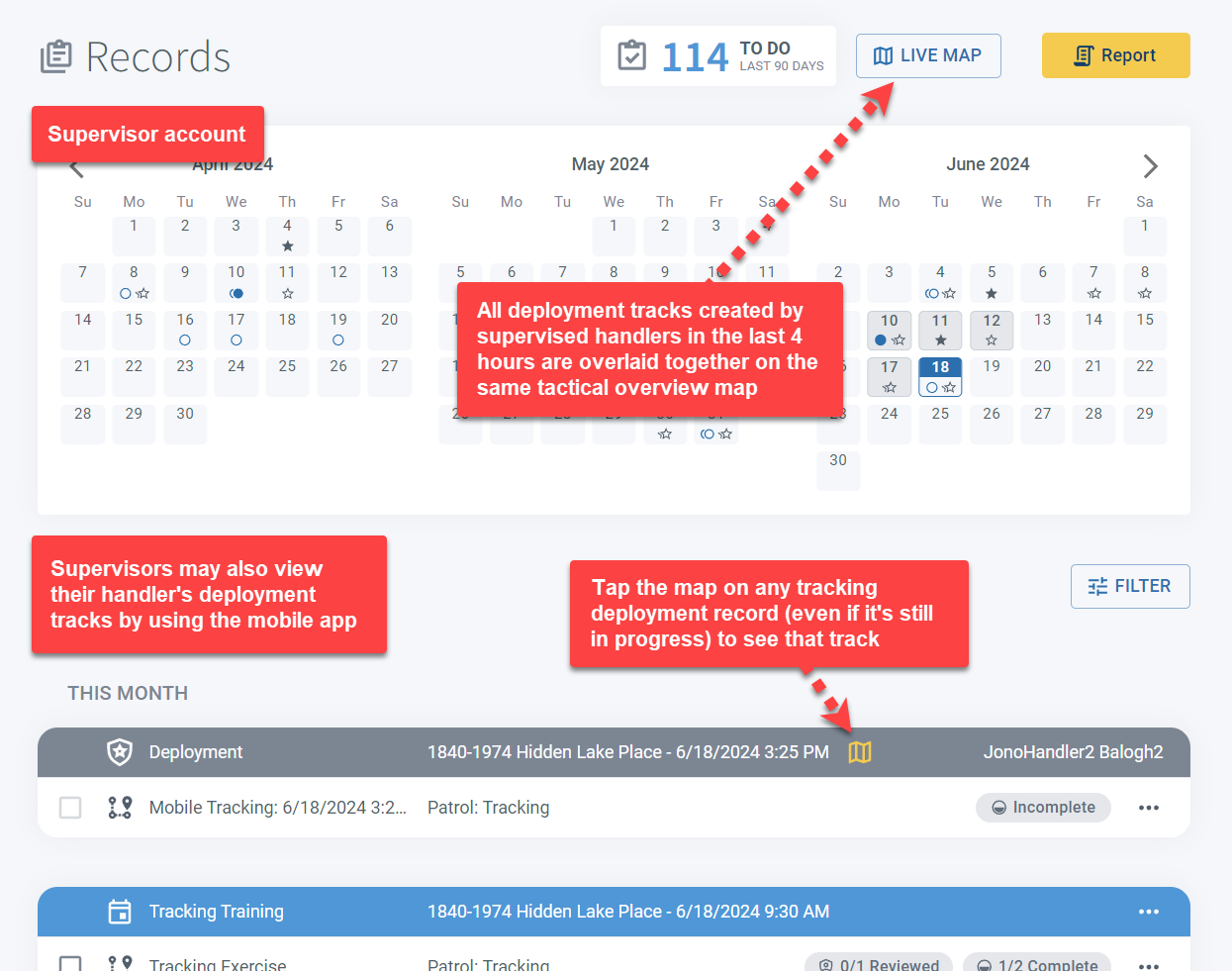
Supervisors have access to each handler’s deployment tracks and can monitor their progress in real-time. They can also watch multiple deployed K9 teams in the same area as they move on a shared map.
Location accuracy
PackTrack’s location tracking system uses the GPS in your phone to estimate location and provide a best-effort approximation of your route. GPS accuracy can vary substantially under different conditions.
Factors that may affect the precision and correctness of your track include: the presence of tall buildings, trees and other obstructions; atmospheric conditions including bad weather; GPS system accuracy limitations; and your phone type and age.
At best, with a consistent high quality signal and a clear view of the sky, your tracked position will be within 10 feet of your actual position. Note that location tracking doesn’t work well indoors.
Tips
- Tap anywhere on the title bar below the tracking map to minimize it and see more of the map. Tap again to bring it back.
- Track Layers can use the PackTrack app without an account to lay tracks. Tap the SKIP LOGIN link on the login screen.
- If you drag the map then it won’t follow your changing location. Tap the “Follow Me” arrow button, shown in the bottom right of the map, to recenter your view and enable following.
- During training, Track Followers have the option to follow a track even if the laid track wasn’t recorded. Select the “Follow without laid track” option on the track setup screen.
- Handlers have the option of revealing the laid training track before they follow it. Select the “Visible” option on the Laid Track Visibility button.
- To save time, training records can be automatically created when a track is started. Use the “Create new exercise automatically” option when following a training track.
- Add a location “Pin” to any track when you need to mark a place with a label and/or photo. By default it uses your current location but you can also tap to add a new location on the map.
- Supervisors have direct access to each handler deployment track and can view their tracks in real time. They can also watch multiple deployed K9 teams in the same area as they move on a shared map.
Frequently Asked Questions
Does the track layer need a PackTrack account?
No. The track layer can use the app for free without an account. Tap the SKIP LOGIN link on the login screen.
How long does a laid track stay available?
Laid tracks expire after 3 days if not used by a track follower.
Does PackTrack track my location when I’m not using the tracking feature?
No. Location is only recorded when you actively start a tracking session.
Can supervisors watch a deployment track in real time?
Yes. Supervisors can monitor individual handler tracks live and view multiple K9 teams on a shared map.
Does location tracking work indoors?
Not reliably. GPS accuracy depends on a clear view of the sky and can be affected by buildings, trees, weather, and other obstructions.

Still need help?
Can't find what you're looking for? Message the PackTrack team from the chat inside the app, or reply to any PackTrack email.